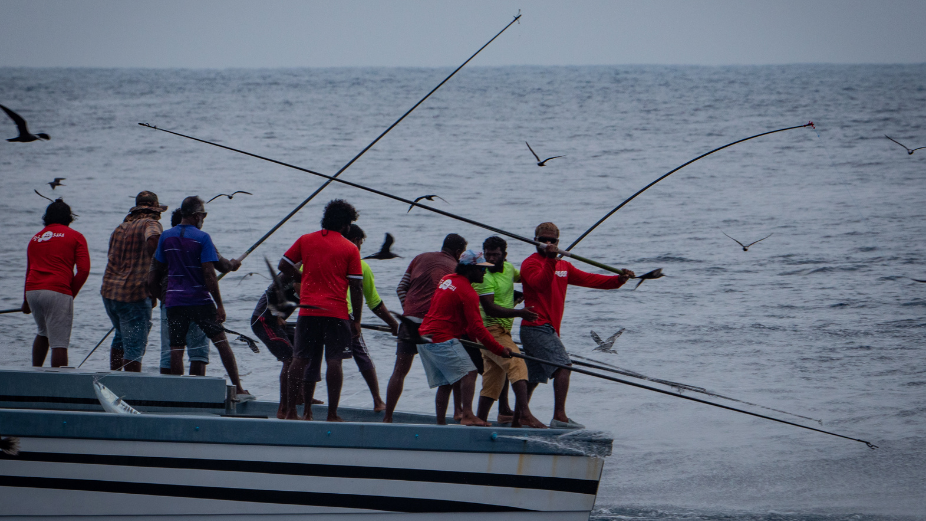
A six-month ocean use survey by Noo Raajje has commenced to identify areas of importance to Maldivian fishermen, communities, individuals, the tourism industry stakeholders and others.
The purpose of the ocean use survey is to further identify the economic, cultural and environmental ties between the Maldives and the ocean. In this regard, the survey will identify important areas for Maldivian ocean users and make it easier to identify ways to protect and manage marine life. The purpose of the survey is to ensure the participation of users of marine resources when formulating the Marine Spatial Plan of the Maldives.
The survey team aims to identify and assess the use of marine areas with the participation of as many people as possible from all over the country. In this regard, discussions will be held with fisheries, tourism and infrastructure stakeholders to determine the use of Maldivian waters. After collecting the results of individual surveys, heatmaps will be compiled highlighting the areas commonly used by Maldivians for fisheries, tourism, entertainment and other purposes. The maps are created through the ‘SeasCatch’ tool developed by the McClintock Lab at the University of California, Santa Barbara, which is used around the world to consult with and gather stakeholder and community views.
The findings of the survey will help promote sustainable fisheries and tourism within the government’s blue economy. The results of the survey will also be used to identify protected marine areas in order to achieve the government’s goal of making 20 percent of the Maldivian economic waters protected. Speaking on the Ocean Use Survey, the Minister of Fisheries, Marine Resources and Agriculture, Dr. Hussain Rasheed Hassan stated:
“As this is the first survey to identify the use of individual areas of the Maldivian ocean, we would like everyone to participate in this important survey. The information provided by the survey will be important for the sustainable use of Maldivian marine resources and for future generations.”
The Noo Raajje Program requests the public to participate in the survey. Visit nooraajje.org/oceanusesurvey to attend the survey online. The survey facilitators will meet with stakeholders in each island and gather information. Noo Raajje assures that the individual responses received through the survey will be kept confidential. Furthermore, heatmaps compiled from the results of the survey will be made available to the Maldivian government and the general public. These heatmaps will also help inform the development of the Maldivian blue economy and marine spatial planning.
For more information, visit https://www.nooraajje.org/


