- The Maldives urged that global land degradation reporting methods be adapted to Small Island Developing States' unique geography and monitoring constraints.
- Officials highlighted technical difficulties with the UNCCD's PRAIS system and low-resolution satellite imagery that miss fine-scale land and coastal changes.
- The Maldives sought higher-resolution data, technical assistance and capacity-building to improve national reporting accuracy under the Convention.
The Maldives has called for global land degradation reporting methods to be adapted to the geography and monitoring constraints of Small Island Developing States, warning that current tools may overlook environmental changes significant to low-lying atoll nations.
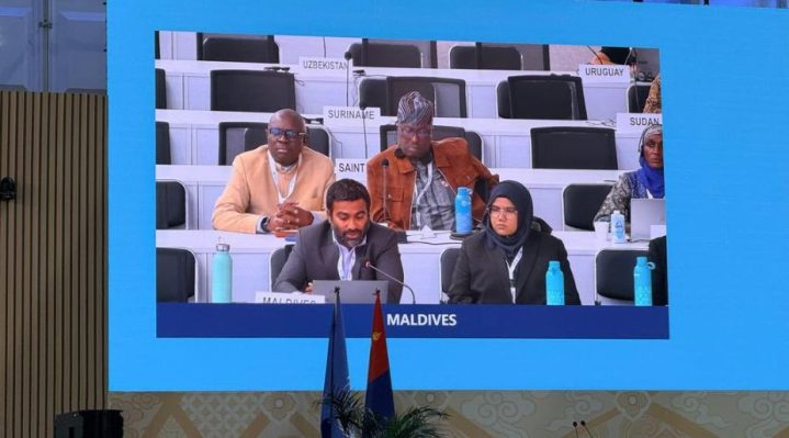
Director of Knowledge Management, Research and Assessment Ahmed Shan raised the issue during a panel discussion at the China pavilion on the sidelines of the 17th Conference of the Parties to the United Nations Convention to Combat Desertification in Ulaanbaatar, Mongolia.







The panel examined national reporting conditions, implementation barriers and capacity requirements across East, South and South-East Asia.
Shan highlighted technical difficulties encountered by island states when using the UNCCD’s Performance Review and Assessment of Implementation System, known as PRAIS. The platform is used by countries to report information on land cover, land degradation and progress towards the objectives of the Convention.
According to the Ministry of Climate Change, Environment and Energy, the system’s structure and data requirements do not always reflect the circumstances of countries with limited land area, geographically dispersed islands and restricted monitoring capacity.
The Maldives also raised concerns about the satellite imagery used in land cover classification products. The resolution of existing imagery may not capture fine-scale land degradation and coastal changes that are important for environmental assessment and planning in an atoll nation.
While such changes may cover relatively small areas in global datasets, they can carry considerable environmental consequences for individual islands where land is scarce and terrestrial and coastal systems are closely connected.
The Maldives called for reporting methodologies that better accommodate the geographical characteristics of SIDS. It also sought access to higher-resolution data, greater technical assistance and specialised capacity-building to improve the accuracy of national reporting and implementation under the Convention.
Shan is attending COP17 alongside Senior Surveyor Aishath Alhan Hameed. The conference is being held from 17 to 28 August under the theme “Restoring Land. Restoring Hope.”
Discussions at COP17 include proposals to translate national drought plans into operational measures through early warning systems and risk financing. Parties are also examining the restoration of agricultural land, soils and rangelands, as well as financing mechanisms intended to attract public and private investment.
The Maldives has said it will continue working with other SIDS and international partners to promote integrated approaches that protect terrestrial and nearshore ecosystems while accounting for the monitoring and implementation constraints faced by island states.